|
Tangible Topography: A Haptic Mapping Interface H. Hawkeye King, Regina Donlin Department of Electrical Engineering University of Washington Seattle, WA, 98195 |
|
| Project poster | |
|
Introduction Haptics changes the way we interact with our computers. The continuing question is “what applications of haptics will be useful, and what benefits will we derive from this technology?” We think that haptics may have tremendous benefit to working with maps and GIS data. We present a web-service mashup that incorporates GIS data from several servers and renders the data both graphically and haptically for an enhanced user experience. Our application, Tangible Topography™ incorporates data from two different free GIS servers to generate a touchable haptic landscape based on real Earth data. The Phantom Omni by Sensable Inc. is used to interface with, i.e. touch, the map. The aim of this project is to give users a greater understanding of geographic regions by augmenting traditional maps with new sensory information. Traditional maps offer visual information alone; our haptic map allows users to trace the contours of an elevation map of a region displayed on a computer screen using the Omni’s stylus. |
|
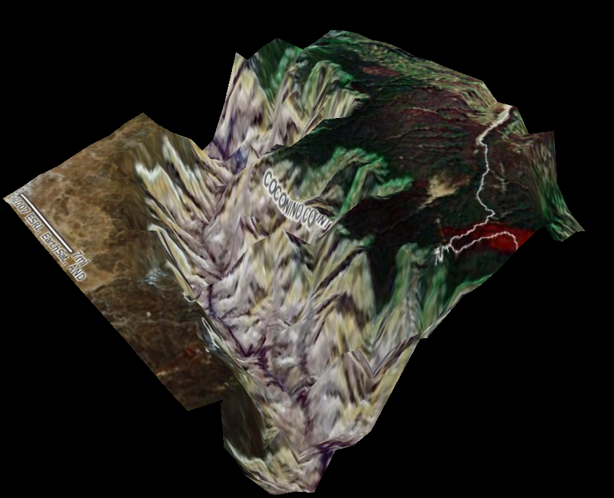 Grand Canyon Rendering |
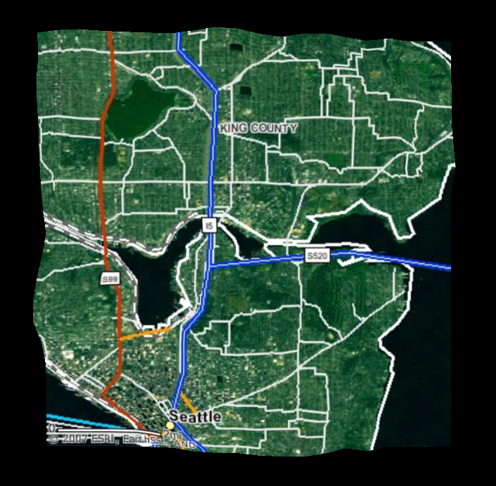 Explore your own neighborhood geography! |
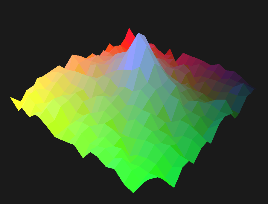 Polygon surface without texture map. Surface polygons are triangles with 3-D vertices specified in (latitude, longitude, elevation). |
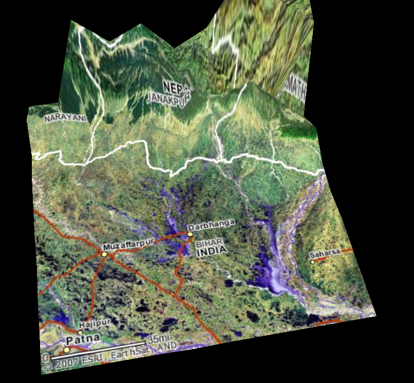 Border of India and Nepal arouses natural curiosity and invites geography and geology lessons. |
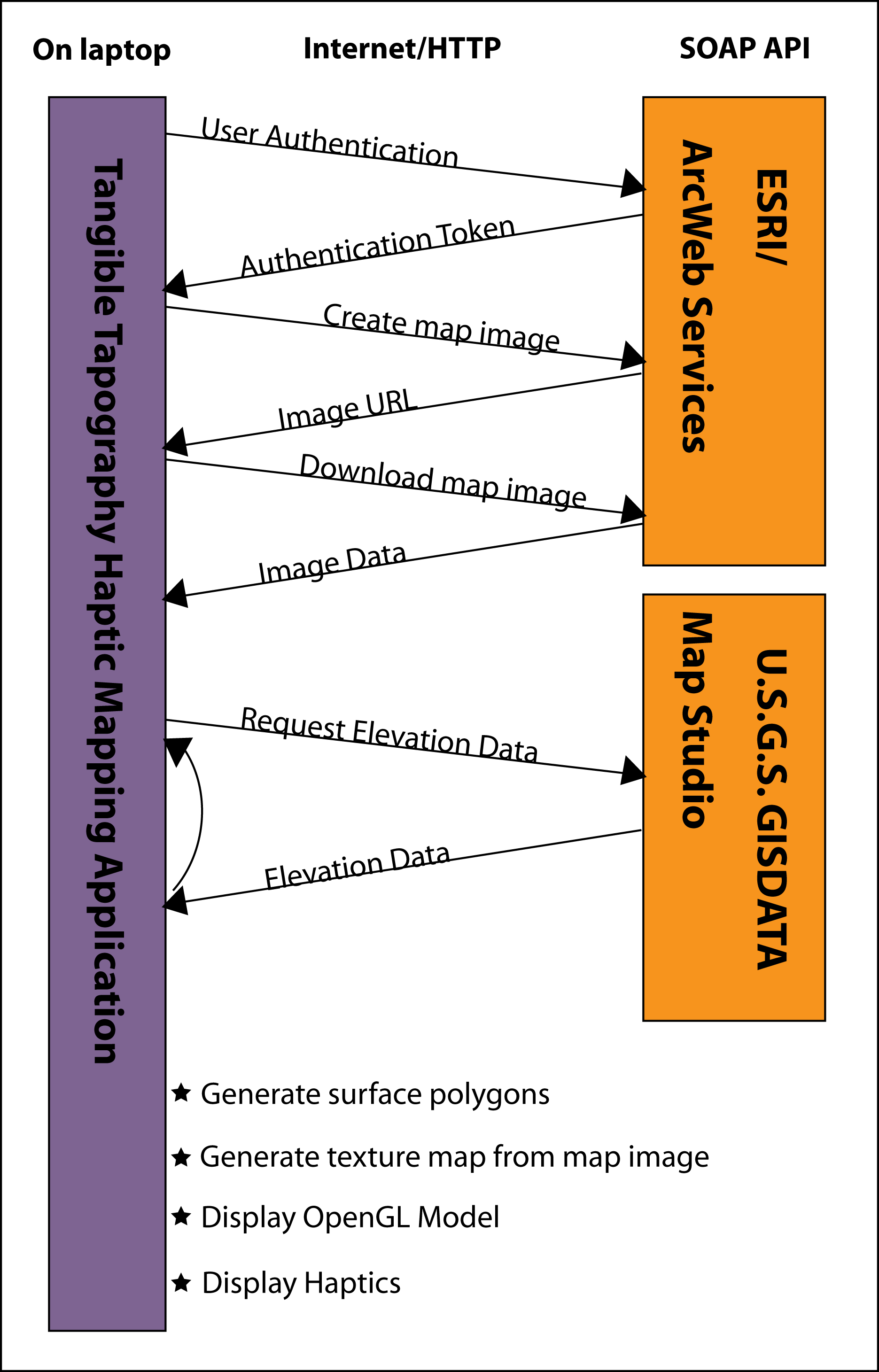 Schematic diagram of data requets and terrain map construction |
|